Terrain Profile
My Numbers
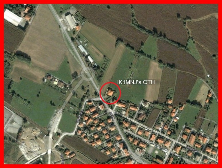
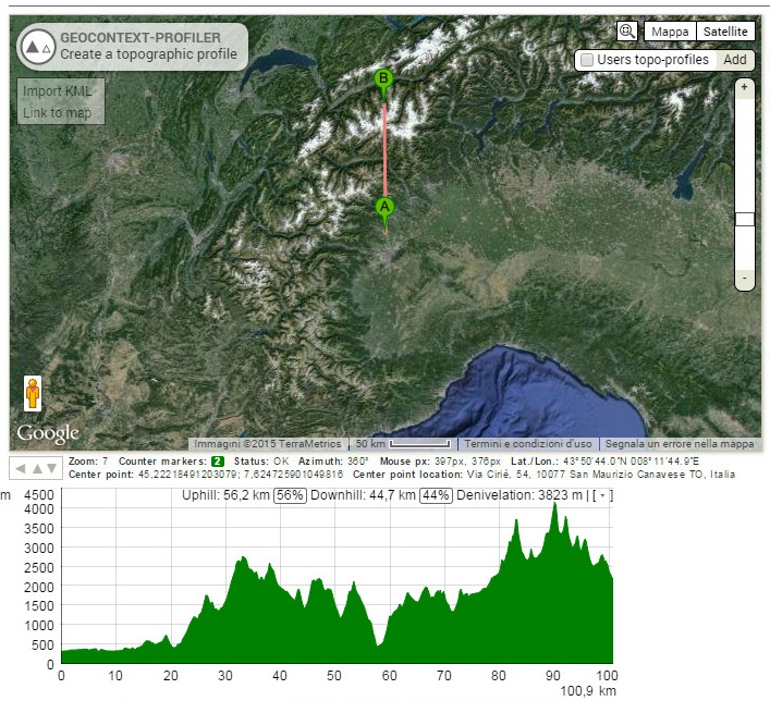
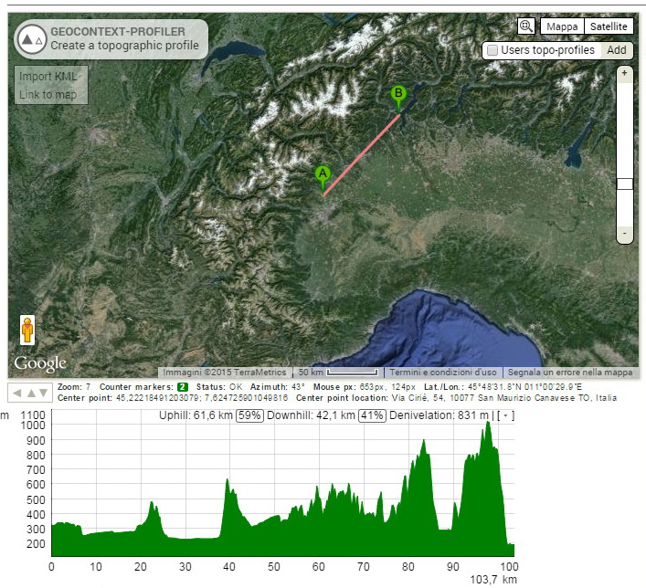
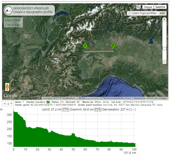
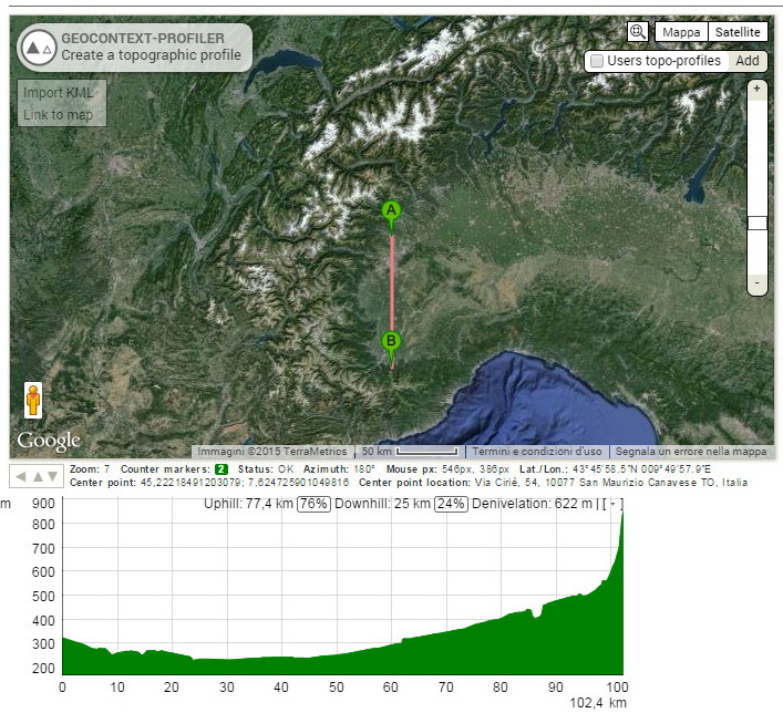
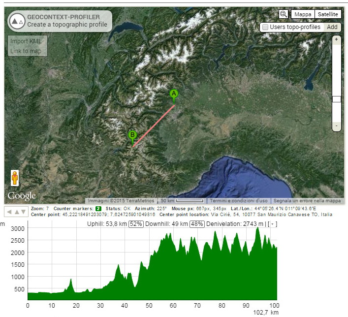
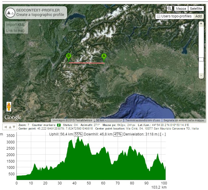
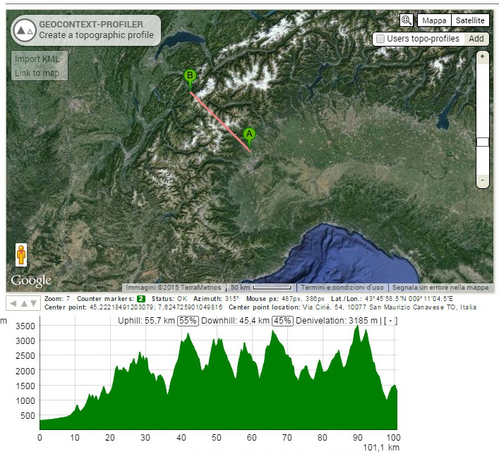
Here down screen capture of my QTH, Locator JN35TF - Latitude 45° 13' 23.56" North, Longitude 7° 37' 19,84" South, elevation 325 m. - 975 Feet. and slideshow of my Terrain Profile around My QTH (A) made with Geocontext towards eight directions, North, North-East, East, South-East, South, South-West, West and North-West, the tracks is 100 kilometers wide, as you see especially in the direction of North, North-West and West and South-West the first high mountains on the 1500/2000 meters and higher are pretty close, about 15-20 Km, I believe that they influence of the transceiver signals especially on the higher bands 10/12/15 m., about my position in general, it's not one of the best indeed, however I try to get the best ...